

What's New
Aerial History of Harvey Cedars
Photos and history by Margaret Thomas Buchholz
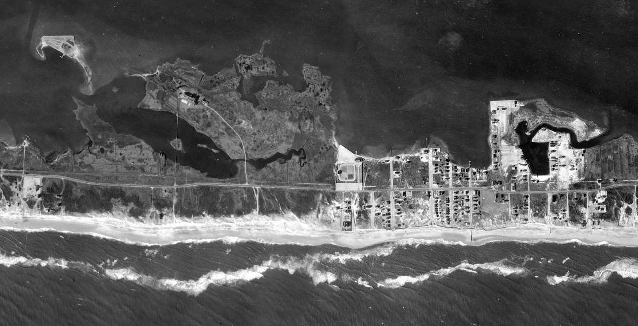
1919 Aerial View of High Point. Kinsey Cove is on the right; the earliest references to this water designated it a “pond”, and the cut into the end of the creek is so straight I am convinced that Kinsey, or someone, cut through from the bay to the interior water, but I have no evidence. Rows of houses line E. 77th and Lee Ave., with two houses dotted on the west side of 77th, both still there, and several on the bay between the two streets. Kinsey’s general store at NE corner of 78th and the original yacht club he built on the bayfront are still there. His eelgrass storage barn is on the NE corner of what will eventually be 80th St. and one of the two little cottages on the east side of the road is now Stonehenge Construction. This photo was a part of the U.S. Government’s first aerial coastal survey.

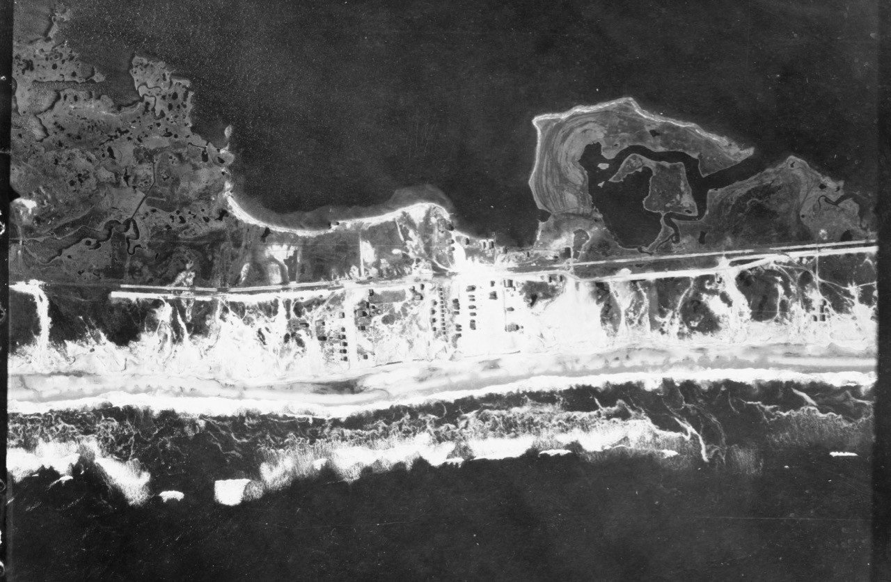
1919 Harvey Cedars (south end). Nothing much built in the original Harvey Cedars except the large Fenimore oceanfront home and pavilion at the end of what is now Atlantic Avenue. The train station is barely visible along the straight line from the ocean to bay, and across Harvest Cove leading to the Harvey Cedars Hotel, now the Bible Conference. Follow the white line on top left, a wooden walkway, out the claw-like projection to Woods Island, where a large home was built. The island has totally eroded. All the white sections are sand and surf and the dark sections are green meadows, or marshland. The only place to see what the original bayside of the Island looked like now is the open land behind the LBI Art Foundation in Loveladies.
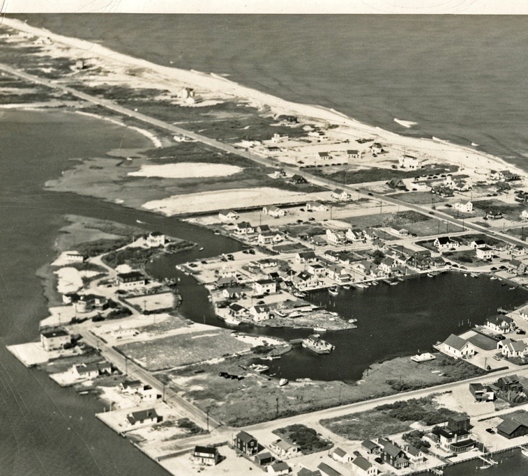
1933 Aerial View of Harvey Cedars. At the depth of the Great Depression, Frederick P Small started construction of his ocean-to-bay estate and gardens (now Sisters of Charity). President of American Express, he was a benevolent capitalist, delivering turkeys to all town residents for both Thanksgiving and Christmas. By now the Barnegat Light Yacht Club at the end of 76th St. is five years old and the Public Dock at the end of 78th St. has been enlarged. There is a very tiny Borough Hall at the same location of the current one. Maiden Lane and Kinsey Lane are gravel roads and the shoreline in Kinsey Cove and around the corner of what is now 80th St. and Maiden Lane bulkheaded. The only house on Bay Terrace is now the Murphy house. My house down the street would be built two years later, before there was a road. There are about 80 homes on the oceanside but nothing has been developed on the south end. The Coast Guard Station, now the LBI Fishing Club in the only building on the oceanside except for the Fenimore house, which was destroyed in the 1944 hurricane.
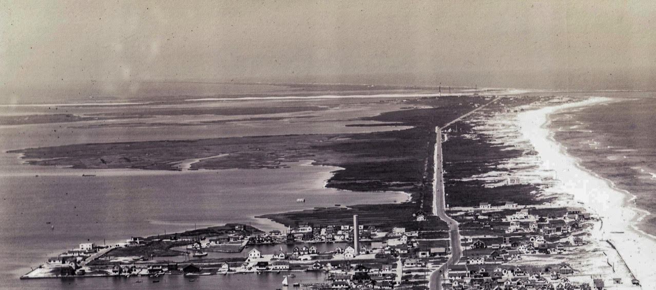
HARVEY CEDARS 1939. A vast panorama with a view across Barnegat Inlet to Island Beach State Park (at this time called The Phipps Estate). Not much action but a sailboat in Kinsey Cove and off the public dock. You can see the line of the railroad tracks to the left of the Boulevard heading north out of town. Nothing else but one oceanfront house just into Loveladies owned by U.S. Attorney General Francis Biddle (still standing) and the Loveladies Coast Guard Station. The bay front was populated by one tiny gunning shack and mosquitos.
HARVEY CEDARS 1947. A few more homes on the oceanfront built just after the war. A house is under construction on 80th St. It was demolished this summer.
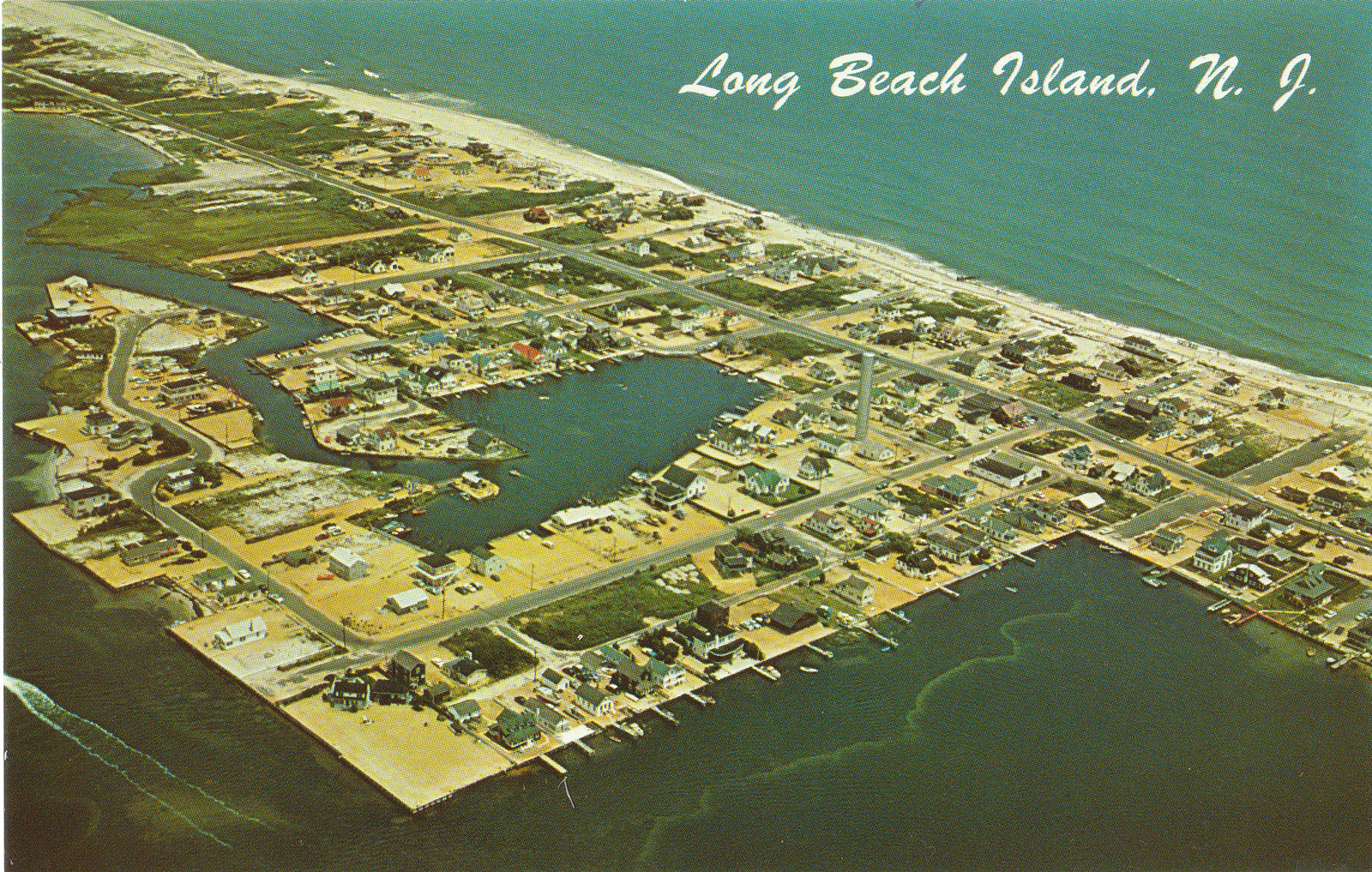 Harvey Cedars 1955: Even though this postcard shot says Long Beach Island, we all know it is the part of Harvey Cedars surrounding Kinsey Cove. And I can date it late summer because that’s when my new duplex on Bay Terrace, with the red Mercury convertible in front, was finished. The most striking thing about this aerial is all the orange gravel and the lack of greenery, except on lots where nothing has yet been built. The beach is very narrow and many of the homes on the east side of the Boulevard would be destroyed seven years later, during the three-day northeaster in March 1962.
.jpg)
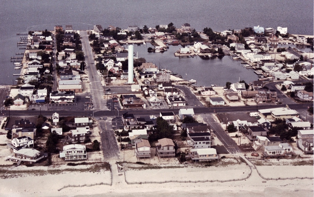
HARVEY CEDARS 1959. This aerial was shot in early summer. I remember, as I was in the plane with the photographer. He came into the Beachcomber office to see if I would put some aerial views of the Island on the front page and I said “Sure, if you take me up for a flight." He did, and the rough landing at Manahawkin Airport (about where the shopping centers are now) was the most frightening experience of my young life. We are about to fly low over my house on Bay Terrace and as we approached my mother was standing in front holding my children by the hands. She told me later how frightened she was. The borough hall has a small addition on the right, the post office, and the coffee shop across the street; Howard Baum’s new Esso station is there on corner of 78th St., and Neptune Market has been built on the corner of 81st St. The most notable difference is the almost total lack of greenery and gardens; no pavers, mostly sand and gravel. And, as the town still used cesspools, very little new construction. Not many more homes north of town than there were 10 years earlier, but you can see the beginnings of Loveladies Harbor at the top.
HARVEY CEDARS 1986. This shot was taken several decades after the LBI Garden Club started selling Japanese pine seedlings. Most of the trees here are pine, mixed in with local cedars. It is before the start of the oversized house-building boom and before the series of regular filling in the beach from offshore dredging.